Millora de la gestió de la capçada i del reg en plantacions tofoneres mitjançant la digitalització i el monitoratge 3D de les explotacions per a incrementar l’eficiència productiva i la sostenibilitat
DIPROTES
Download PdfDescription
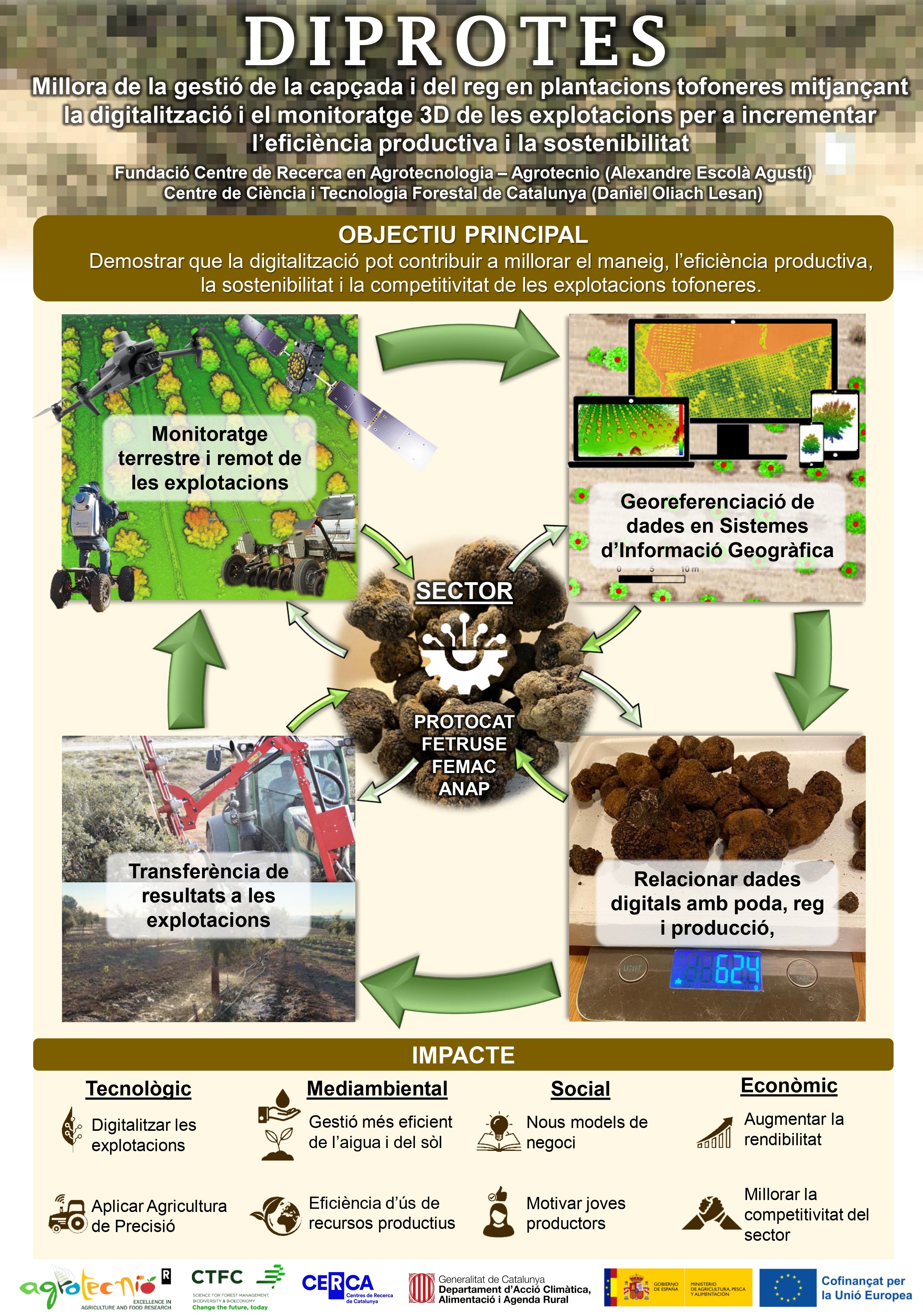
This project aims to transfer Precision Agriculture techniques to the Catalan black truffle production sector. The objective is to improve the production processes of tuber cultivation through the digitalization of farms and the generation of information for management decision-making to increase their productivity, the efficiency of use of resources such as irrigation water and their sustainability. Proximal and remote sensing systems will be used to characterize trees and soil and GNSS receivers to georeference the harvested truffles. Data collection and spatiotemporal analysis will be systematized to obtain relationships between production and management of the crown (pruning), irrigation and soil work to transfer to the sector. The improvement of the black truffle production process is aligned with the Strategic Plan for the truffle sector in Catalonia, of the DARP. The activity is a collaboration between the CERCA Agrotecnio centers and the Center for Forest Science and Technology of Catalonia. The first provides knowledge and equipment for Precision Agriculture and the second for tuber cultivation, in addition to its demonstration fields.
Objective
To demonstrate that the digitalization of truffle farms through georeferencing data in geographic information systems and terrestrial and remote monitoring of trees can contribute to optimizing their management, increasing their productive efficiency and sustainability and, therefore, increasing their competitiveness.
Partners
This project is a collaboration between the CERCA center Agrotecnio and the Centre de Ciència i Tecnologia Forestal de Catalunya.
Infographic
Science Outreach Articles
Precision Truffle Cultivation: Use of GNSS Receivers for Truffle Geolocalization in Black Truffle (Tuber melanosporum Vittad.) Plantations
Authors: Jose Manuel Plata, Dalmau Albó, Daniel Oliach, and Àlex Escolà
Abstract: Traditionally, the underground nature of the black truffle and its harvesting using truffle dogs have hindered the monitoring of its maturation and yield, a fact that often leads to the loss of accurate information regarding production per tree and at the plot level. This study validates a methodology applied to a holm oak plantation in full production, geolocating both a set of five trees and their subsequent weekly harvest with centimeter precision. This was achieved through a workflow structured into three phases: in situ marking, georeferencing, and integration into a Geographic Information System (GIS). The results indicate the importance of geolocalization, as high spatial heterogeneity exists and significant variations in truffle weight and quantity are recorded in trees that are very close to one another. Furthermore, individual spatial mapping evidences that, even within the same tree, there are areas with higher truffle production. In the case of the most productive tree, 50% of the truffles were concentrated at a distance of between 1 m and 1.5 m from the trunk, while also showing lower production on the northern side.
Link: Article divulgatiu 1_CAT
3D Models as Allies: How to Measure Growth and Pruning Intensity in Truffle Holm Oaks (Quercus ilex subsp. ballota (Desf.) Samp.) with LiDAR Technology
Authors: Jose Manuel Plata, Dalmau Albó, Daniel Oliach, and Àlex Escolà
Abstract: The vigor and morphology of the host tree directly influence the production of the symbiotic fungus, a fact that justifies exhaustive monitoring of holm oaks to evaluate how they intervene in black truffle production. To this end, a portable system based on LiDAR technology was used to monitor a farm in Querol during the 2025 campaign. The monitoring included five scans comprising the pre-pruning and post-pruning stages, as well as three subsequent re-sproutings, in order to compare a control holm oak (without any type of intervention) with another subjected to pruning. Following the processing of the obtained point clouds, the volume, height, and width of the tree crowns were accurately quantified. Volumetric data indicated that, considering the beginning and the end of the campaign, the control specimen grew by 80 % (from 5.4 m³ to 9.8 m³), while the pruned tree increased its volume by 20 % (from 6.6 m³ to 8 m³). Nonetheless, if the post-pruning stage is used as the starting point, it is observed that the pruned specimen (which had suffered a 20 % reduction in its volume due to the intervention) subsequently reacted with vigorous vertical growth. The study concludes that LiDAR sensors allow guaranteeing the traceability of interventions and optimizing the sustainable and digitalized management of the sector.
Link: Article divulgatiu 2_CAT
Activitat cofinançada per la UE a través de la intervenció 7201
del Pla estratègic de la PAC 2023-2027